Table of Contents >> Show >> Hide
- Why Pigs? The (Surprisingly Practical) Science Behind the Choice
- The Crisis Driving the Research: Mexico’s “Disappeared”
- How the Pig-Burial Experiments Work (Without the Horror-Movie Version)
- What Scientists Look For: The Environmental Clues That Can Point to a Hidden Grave
- 1) Soil Chemistry: When the Ground Keeps Receipts
- 2) Insects: Tiny Witnesses With a Very Specific Resume
- 3) Vegetation: When Plants Become Accidental Highlighters
- 4) Geophysics: Seeing Disturbed Ground Without Digging Everywhere
- 5) Drones + Multispectral/Hyperspectral Imaging: The Sky’s-Eye Clue Finder
- How This Research Helps in the Real World
- Technology Isn’t a Magic Wand (But It Can Be a Better Flashlight)
- Ethics: Respecting Victims While Studying the Earth
- What Comes Next: Smarter Searches, Shared Methods, Better Outcomes
- Conclusion: A Strange Method With a Serious Mission
- Field Experiences Around This Work (A 500-Word Add-On)
If you’ve ever thought, “Science is amazing,” and then immediately followed it with, “Science is also a little weird,”
welcome to today’s lesson in forensic innovation.
In Mexicowhere tens of thousands of families are searching for missing loved onesresearchers and search teams are
building better ways to locate clandestine graves. Their toolkit includes drones, advanced imaging sensors, soil analysis,
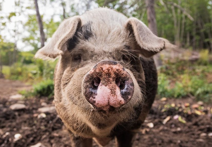
and an unexpected helper: pig carcasses. Not because anyone is trying to make a grim science fair project,
but because pigs can serve as a practical stand-in for understanding how buried human remains affect the environment.
The goal isn’t shock value. It’s better detection, fewer false leads, and more answers
for families who have been forced to become investigators, advocates, and searchers all at once. This is forensic science doing what it
does best: reading subtle clues the rest of us would never noticelike a detective with a lab coat and a soil sample.
Why Pigs? The (Surprisingly Practical) Science Behind the Choice
In forensic research, scientists often need realistic “models” to test how burial sites change over time. Using actual human bodies is
ethically complex, legally restricted, and logistically limited. Pigs, on the other hand, are commonly used in forensic studies because their
body composition and size can make them a helpful analogue for certain research questions.
Think of it like a crash-test dummy for the underground. The researchers aren’t trying to recreate every detail of a real case; they’re trying to
understand patterns: What changes in the soil? What changes in plants? What can sensors detect?
And the reason this matters is simple: clandestine graves are intentionally designed to be hard to find.
Yes, it’s uncomfortable. It should be. But it’s also purposeful: if scientists can map out “environmental signatures” that tend to appear near
clandestine burials, search teams can prioritize where to look, use resources more efficiently, and potentially find sites sooner.
The Crisis Driving the Research: Mexico’s “Disappeared”
Mexico has faced a long-running crisis of disappearances tied to organized crime, corruption, and violence. Official tallies of missing persons
have climbed into the six figures, with some recent reporting placing the figure at over 130,000.
Behind every number is a family living in a painful limbono confirmation, no closure, and often no reliable institutional support.
In many regions, volunteer collectivesfrequently made up of relatives of the missinghave led searches using on-the-ground knowledge:
reading terrain, watching for disturbed soil, noticing unusual vegetation, and carefully scanning areas that “feel wrong” in a way that’s hard to
put into words but easy to recognize when you’ve been searching for years.
The new wave of research aims to honor that lived expertise while adding a layer of measurement and technology. In other words:
community knowledge + scientific tools = better odds. It’s not a replacement; it’s reinforcement.
How the Pig-Burial Experiments Work (Without the Horror-Movie Version)
The basic idea is controlled comparison. Researchers place pig remains under different conditions to observe how the surrounding environment changes.
They may vary factors like burial depth, soil type, or surface cover. Some studies also incorporate clothing or wrapping materials to reflect the real-world
complexity that search teams face.
Then they measure. And measure. And measure againbecause nature doesn’t send a push notification that says,
“Congrats! You found a clandestine grave!” Instead, the evidence shows up as subtle shifts: a soil chemistry pattern, a plant-growth anomaly,
a thermal or multispectral “signal,” or a geophysical change that suggests disturbed ground.
This is where the science gets both fascinating and useful. A clandestine burial site can become a tiny “ecosystem event” in the soil.
Researchers track that event the same way an ecologist might track a changing habitatonly the goal is forensic detection and humanitarian recovery.
What Scientists Look For: The Environmental Clues That Can Point to a Hidden Grave
1) Soil Chemistry: When the Ground Keeps Receipts
Soil isn’t just dirt. It’s a chemical soupminerals, microbes, moisture, organic matterand it reacts to changes. When organic material is buried,
it can alter local soil chemistry in measurable ways. That might include shifts in nutrient concentrations, pH, or other chemical markers that sensors
and lab analyses can detect.
The key word is pattern. Scientists aren’t looking for one magical “grave chemical.” They’re looking for a consistent combination of changes
that tends to show up more often in burial simulations than in control soils nearby.
2) Insects: Tiny Witnesses With a Very Specific Resume
Forensic entomology has long used insect activity to help estimate timelines and understand what happened at a scene. In burial contexts, insects can still
matternot as a dramatic TV montage, but as data. Different insects thrive in different conditions, and their presence (or absence) can help researchers understand
what’s happening in the buried environment.
This can be especially useful when paired with other tools: if soil chemistry suggests something unusual and insect patterns also shift in the same area,
investigators may have greater confidence that a site deserves closer examination.
3) Vegetation: When Plants Become Accidental Highlighters
One of the most promising detection angles involves plants. Certain burial sites can affect plant growth because the soil chemistry and moisture profile changes.
Sometimes plants grow more vigorously; sometimes they struggle; sometimes the species mix looks “off” compared to the surrounding area.
This ideausing botanical and ecological signals in forensic searchesisn’t brand new, but applying it systematically in Mexico’s search context is.
It also connects directly to what many search collectives have long reported: that the land can “look different” above certain sites.
Research helps translate that observation into measurable indicators.
Importantly, vegetation signals are not proof. Weather, irrigation, shade, soil compaction, and human activity can all change plant growth.
But as part of a layered approach, vegetation can be a valuable clueespecially when analyzed with imaging sensors.
4) Geophysics: Seeing Disturbed Ground Without Digging Everywhere
Digging is slow, expensive, and emotionally exhausting. That’s why search teams often use geophysical methods to scan areas before excavation.
Techniques can include ground-penetrating radar (GPR) and electrical resistivity, which look for subsurface anomalies
like disturbed soil layers, voids, or moisture differences.
These tools can help narrow search zones, but they have limits. Natural rocks, debris, roots, and other buried materials can create confusing signals.
That’s one reason the pig-burial experiments matter: they help researchers learn what a “realistic” burial anomaly looks like under local conditions,
which can reduce false positives.
5) Drones + Multispectral/Hyperspectral Imaging: The Sky’s-Eye Clue Finder
If you’ve ever seen a drone video and thought, “Cool, it’s like a fancy camera,” you’re only seeing the appetizer. Some drones carry sensors that capture
information beyond normal human vision. Multispectral and hyperspectral imaging can detect subtle differences in vegetation
health and soil characteristics. Thermal cameras can reveal temperature patterns that sometimes correlate with moisture or soil disturbance.
These tools don’t “spot a grave” like a neon sign. Instead, they can flag areas that look unusualplaces where plant reflectance, moisture signatures,
or terrain patterns differ from the surrounding baseline. Then ground teams can check those areas more carefully.
How This Research Helps in the Real World
The practical benefit of this work is triage. When search teams face huge landscapes and limited time, they need ways to prioritize.
The more accurately they can identify promising zones, the fewer resources get burned on dead ends (no pun intendedseriously).
Here’s what the best-case workflow can look like:
- Step 1: Collect local knowledge (tips, reports, historical patterns, community observations).
- Step 2: Use mapping and environmental data to narrow the search area.
- Step 3: Fly drones with thermal/multispectral sensors to flag anomalies.
- Step 4: Confirm with ground methods (visual inspection, careful probing, geophysics where appropriate).
- Step 5: Excavate methodically with forensic protocols and chain-of-custody safeguards.
The pig research strengthens Steps 2–4 by improving what “anomaly” means in the specific soils, climates, and vegetation of regions like Jalisco.
In forensic work, local calibration is everything. A method that works in one ecosystem can flop in another.
Technology Isn’t a Magic Wand (But It Can Be a Better Flashlight)
It’s tempting to frame this as “science solves the mystery.” Real life isn’t a two-hour movie with a satisfying final scene.
Even the best sensors can’t replace witness information, community trust, and sustained institutional support.
There are also serious constraints:
- Cost and access: Advanced sensors and skilled operators aren’t available everywhere.
- Environmental noise: Rain, drought, construction, trash dumping, and agriculture can obscure signals.
- Time factors: Environmental signatures change over weeks, months, and yearsand not always predictably.
- Safety: Searches can be dangerous in areas controlled by criminal groups; technology can reduce risk but not eliminate it.
- Data responsibility: Geospatial information must be handled carefully to protect families, searchers, and investigations.
The most responsible researchers say the quiet part out loud: the technology is only valuable if it’s usable by the people doing the searching,
not just impressive in a report. That means training, transparency, and collaboration with families and local commissionsplus the political will
to fund and implement what works.
Ethics: Respecting Victims While Studying the Earth
Any project that simulates clandestine graves carries ethical weight. It must be handled with respect, clear safeguards, and a humanitarian purpose.
The research should never sensationalize suffering, and it should never treat the missing as abstract “data points.”
Many teams emphasize community participation as an ethical anchor: families of the disappeared and local search collectives are not just “stakeholders”
they’re partners with knowledge, priorities, and lived experience. When science is built with that partnership, it has a better chance of producing tools
that actually help on the ground.
What Comes Next: Smarter Searches, Shared Methods, Better Outcomes
The future of clandestine grave detection in Mexico likely won’t hinge on one breakthrough gadget. It will come from combining methods:
forensic anthropology, environmental chemistry, geophysics, drone imaging, machine learning, andcruciallycommunity intelligence.
Expect to see progress in areas like:
- Standardized field protocols for collecting soil/plant/insect samples consistently.
- Improved models that predict likely search zones using terrain, access routes, and historical patterns.
- Better calibration of sensors for specific regions (because Mexico is not one uniform landscape).
- Training programs so technology can be used widely, not just by a few specialized teams.
- Community-centered deployment that prioritizes humanitarian outcomes over headlines.
None of this erases the tragedy that made it necessary. But it can reduce uncertainty, shorten searches, and increase the odds that families get answers.
In that sense, the pig research is less about death than about a stubborn commitment to life: to dignity, to truth, and to not letting people vanish without a trace.
Conclusion: A Strange Method With a Serious Mission
Scientists using dead pigs to find hidden graves sounds like a headline designed to make you blink twice. But behind the oddity is a hard reality:
Mexico’s missing persons crisis demands better tools, better coordination, and better support for the people forced to do the searching.
By studying how burial sites affect soil, plants, insects, and sensor readings, researchers are building a kind of “field guide” to the land’s subtle signals.
The work is methodical, unglamorous, and emotionally heavy. And it mattersbecause every improvement in detection can mean fewer false starts,
safer searches, and a higher chance that the missing are found and identified.
It’s not the kind of science anyone wishes we needed. But as long as families are searching, science has a responsibility to helpone soil sample at a time.
Field Experiences Around This Work (A 500-Word Add-On)
For people who haven’t joined a search, it’s easy to imagine this research as a sterile lab project: data points, drone flights, tidy charts, a clean conclusion.
The reality is more humanand more complicated.
A typical “field day” for a team working on clandestine grave detection can start early, before heat and wind complicate drone imaging. The first task often isn’t
launching equipment. It’s talkingquietly, carefully, and respectfullywith local searchers and family collectives. These conversations aren’t side notes;
they shape the entire plan. Families share where tips came from, which areas have been searched before, and what the land “usually looks like.”
Scientists listen, take notes, and try not to overpromise. In this world, trust is a precious currency.
Then comes the methodical part. Teams mark out grids, record GPS points, and document baseline conditions. If drones are involved, pilots run checklists:
battery levels, wind, sensor calibration, flight paths. On screens, the landscape becomes layersvisible light, thermal patterns, multispectral signals.
To an untrained eye it can look like abstract art. To a trained team, it’s a map of questions: “Why is that patch warmer?” “Why is that vegetation signature different?”
“Is that a natural drainage pattern, or disturbed soil?”
Back at the labor sometimes in a makeshift field stationthe work shifts from high-tech to hands-on. Soil samples get labeled and stored.
Plant material is examined. Insect samples are sorted. It’s meticulous, sometimes tedious, always precise. People doing this work often develop a dark sense of humor,
not because the subject is funny, but because humor is a human pressure valve. You might hear someone joke that they’re starring in
“CSI: Soil Edition,” and then watch them go right back to careful, respectful documentation.
The pig-burial research adds another layer of experience: it’s where teams learn what “signals” look like under controlled conditions.
When the same types of environmental shifts show up outside the test site, it strengthens confidence that an anomaly is worth investigating.
That confidence matters because excavation is emotionally expensive. Each dig site carries hope and dread at the same time.
What stands out most, though, isn’t the technology. It’s the collaboration. Scientists may bring sensors and analysis, but families bring persistence,
local knowledge, and a refusal to let the missing be forgotten. The best outcomes happen when those strengths combinewhen data respects grief,
and when research is built to serve the people living the crisis, not just studying it.